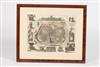
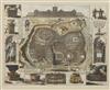
FRAMED HENRIK KEUR MAP OF JERUSALEM DURING THE REIGN OF KING SOLOMON, DATED 1686. From: Biblia. Dordrecht, Hendrick, Jacob and Pieter Keur, and Amsterdam. Marcus Doornick and Pieter Rotterdam, 1702. (?) Drawn after Villalpando with some additions especially of buildings. The surrounding figures are after Richard Blome's plan of Jerusalem.