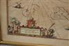
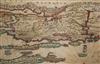
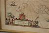
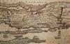
MAP OF DALMATIA, CROATIA, WITH THE COASTLINE OF THE EASTERN ADRIATIC SEA. Antique framed map with a large title across the top: "DALMATIA" and a more detailed cartouche in the lower right corner specifies the area: "LADERA, SIBENICO et NONA Vulgo ZARA, SIBENICO et NONA cum Insulis adjacentibus, in Parte DALMATIÆ Boreali." This translates to "Ladera, Sibenico, and Nona, commonly Zara, Sibenico, and Nona with adjacent islands, in the Northern part of Dalmatia." The map shows the coastline of the eastern Adriatic Sea, including a great number of islands. Framed. Not examined out of frame. - Sight: 19 x 23 inches. Frame; 20 x 24 inches. Estimate $120-160