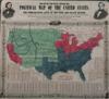
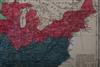
REYNOLD'S POLITICAL MAP OF THE UNITED STATES. Designed to Exhibit the Comparative Area of the Free and Slave States, and the Territory Open to Slavery or Freedom by the Repeal of the Missouri Compromise. With a comparison of the Principal Statistics of the Free and Slave States from the Census of 1850. New York, Wm. C. Reynolds, and J.C.. Jones, 1856 . "This map compares statistics on free and slave states. Issued during the presidential election campaign of 1856, it pictures famous Western explorer John C. Fremont, the first presidential candidate of the Republican Party, and his running mate, William L. Dayton. The Republican Party had been created in 1854 by opponents of the Kansas-Nebraska Bill, which allowed for the expansion of slavery into free territory in the West. Despite gaining thirty-three percent of the popular vote, Fremont lost the election to James Buchanan. Four years later, however, the Republican Party succeeded in electing Abraham Lincoln." (Library of Congress Resource Guide for the Study of Black History & Culture)
P. Lee Phillips, "1901 List of Maps of America", Washington DC, Government Printing Office, 1901, pg. 906 - Unframed, 27 3/4 in. x 30 1/4 in. Estimate $5,000-7,000
PROVENANCE: Collection of Andrew M. Modelski, Library of Congress (Retired) Consultant. Former head, Acquisitions Unit, Principal Recommending Officer, Geography and Map Division
Paper slightly darkened; color apparently faded; folding creases; small loss at lower left edge, corners clipped; 1/2 in. tear at upper right edge.