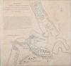
MAP SHOWING THE ATTACK OF THE REBELS UPON FORT PENOBSCOT IN THE PROVINCE OF NEW ENGLAND,published for NicholasTindal's translation of M. Rapin de Thoyras' "History of England", 1785. Showing the positions of the American and British fleets, engraving, unframed, plate: 14 1/2 in. x 15 3/4 in.
TOGETHER WITH:
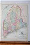
A MAP OF MAINE A.J. Coolidge, Boston, 1859, engraving with hand-coloring, unframed, sheet size: 23 in. x 16 1/2 in. Estimate $1,000-1,500